
Channing Hill, Benicia Live Cam
| Status: | Webcam online |
| Country: |  United States (USA) |
| Timezone: | GMT-07:00 |
| Tags: | |
| Broadcast last updated: | 21.10.2026 |
| Webcam last checked: | 22.10.2026 |
Weather and time
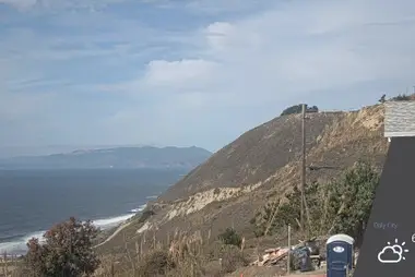
This webcam looks north-northeast across rooftops in Benicia to the grassy slope of Channing Hill, a local paragliding site. Footpaths wind up the open hillside through dry grass and patches of low shrubs.
Benicia sits on the north shore of the Carquinez Strait in Solano County and briefly served as the capital of California in the 1850s. Channing Hill rises at the northern edge of town, above the Channing Circle neighborhood and a small park at its foot. Paragliding pilots walk up through the park to launch from the top, using the west side in westerly wind.
The camera looks over nearby houses, so gray shingles and treetops fill the lower edge of the frame. Above them, the western flank of the hill stretches across the picture, with a trail zigzagging up its left side. A weather panel in the corner shows temperature, wind and a short forecast.











 Español
 Deutsch
 Français
 日本語
 Italiano
 Polski
 Português
 Nederlands
 Русский
 Türkçe
 简体中文
 한국어
 Tiếng Việt


