Live Cams in Rivière Noire District
Rivière Noire District, Mauritius
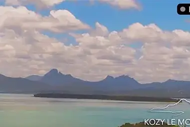
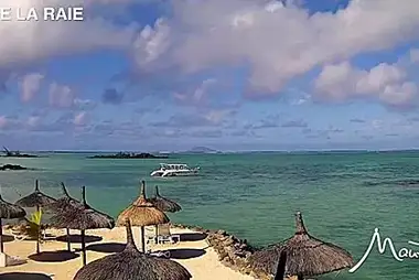
The Rivière Noire District, also known as the Black River District, is located on the western side of the Indian Ocean island of Mauritius.Its territory is mostly rural, and it includes the western outskirts of Mauritius' capital city, Port Louis, as well as the western outskirts of the town of Quatre Bornes.Rivière Noire has stunning landscapes, as seen on the live webcams, sand beaches, and some of the most scenic destinations on the island, such as the Tamarind Falls, one of Mauritius' most beautiful waterfalls.This District is home to the iconic Le Morne Brabant, a prominent rock peak that once housed runaway slaves. This area in the extreme west of the island offers a paradisiacal lagoon with a coral island in the middle, a setting that you can enjoy from comfortable resorts in the Le Morne locality or in the village of La Gaulette.The district is part of the Black River Gorges National Park, which has hiking trails that wind through the lush indigenous forests. Tourists also enjoy visiting the Chamarel Seven Coloured Earth Geopark in Rivière Noire District, where seven colours appear in the sand dunes within an appealing geopark.Flic en Flac beach, one of Mauritius' longest, is one of the most popular sandy beaches.Population: approximately 90 thousand residents Major towns and villages: Bambous, Black River, Flic en Flac Main attractions: Le Morne Brabant, seven Coloured Earths (Chamarel plain), Black River Gorges National Park, Flic-en-Flac Beach, Tamarind FallsNearest Airports: Sir Seewoosagur Ramgoolam International Airport (MRU - Aéroport International Sir Seewoosagur Ramgoolam)